Latest Photo Galleries


Brazilian Markets
15h06 Bovespa |
-0,34% | 123.744 |
16h43 Gold |
0,00% | 117 |
15h03 Dollar |
+0,33% | 5,2598 |
16h30 Euro |
+0,49% | 2,65250 |
ADVERTISING
Brazilian Government Postpones Release of Amazon Deforestation Data
10/16/2014 - 09h23
Advertising
MARCELO LEITE
FROM SÃO PAULO
Dilma Rousseff's government has postponed the release of partial data on deforestation in the Amazon until after the second round of the presidential election.
In 2013 there was an increase in deforestation rates, which reached 29% after a decade in decline.
According to the Ministry of the Environment, a meeting that took place last Tuesday, October 14th, determined that the numbers regarding the months of August and September will be published only in November.
Usually, the data collected by Deter (The System for Real Time Detection of Deforestation) is released monthly from May to October.
During these months the sky is less cloudy, which enables better satellite imaging.
The latest report published by Inpe (The National Institute for Space Research), which operates Deter, dates back to July. It was released online on August 6th.
The Ministry's press office reckons that this occurrence is not actually a delayed release because Deter is a regulatory tool whose data are used to help Ibama (Brazilian Institute of Environment and Renewable Natural Resources) in the efforts against deforestation.
Inpe points out that Deter only collects data on part of the felled land due to the low image and sensors resolution and the restrictions due to cloud density.
Closer monitoring of felled areas is under the responsibility of another system, called Prodes. It employs even more powerful satellite sensors but it only releases results once a year, usually in November.
However, Inpe itself has said that Deter was developed as a support tool for monitoring deforestation, and in addition to this, the system can be used to identify trends across year-long felling rates.
The Ministry for the Environment has informed that the data from the months still pending will have their release dates announced alongside New Deter, the improved system that is going to use satellite imaging with better resolution (6,25 hectares against 25 hectares in its previous version).
The release date should coincide with the issuing of results by Prodes.
Translated by CRISTIANE COSTA LIMA
Read the article in the original language
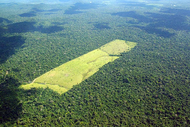
| Ayrton Vignola - 17mai.05/Folhapress | ||
 |
||
| In 2013 there was an increase in deforestation rates, which reached 29% after a decade in decline |